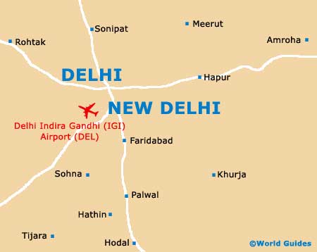
Delhi Indira Gandhi International Airport (DEL)
Orientation and Maps
(Delhi, India)
Often abbreviated as simply NCT, the National Capital Territory of Delhi is a vast and spreading area, with a dense populous and an overall population exceeding 15 million. Delhi is located on the northern side of India and features an enormous number of monuments and temples, many of which are close to the Yamuna River and also the Aravalli Hills. New Delhi is a large region within this territory and stands on the western side of the river. The capital of India and home to the area's governments, New Delhi stands on the southern side of the Old City.
Located in the outlying southern suburbs of New Delhi, the Indira Gandhi International Airport (DEL) is one of the country's premier gateways and is also known as IGI Airport. With a capacity of over seven million passengers every year, Indira Gandhi Airport is named after a past Prime Minister.
Delhi Indira Gandhi International Airport (DEL) Maps: Important City Districts
Central Delhi is where New Delhi is located and this area is particularly tourist-friendly. With local markets, churches and restaurants, other highlights include the Parliament House (better known as Sansad Bhavan), India Gate in the Rajpath area, and the Rashtrapati Bhavan (the official home of India's president).
The northern side of Delhi is home to a labyrinth of narrow roads, local shops and enormous markets. This is also where you will find the lively and youthful university area, around the Delhi University. This university dates back to 1922 and is one of the world's biggest universities, with more than 300,000 students.
Southern Delhi is considered to be a particularly trendy district and features many excellent shopping centres and top dining spots. This area also contains a large park and plenty of historical remains, such as the sandstone tower of the Qutub Minar.
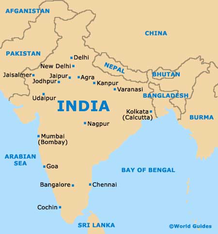
India Map
Delhi Map